The Hardrock Course
Hardrock is a mountain run that passes through some of the most beautiful and rugged mountains in the world.
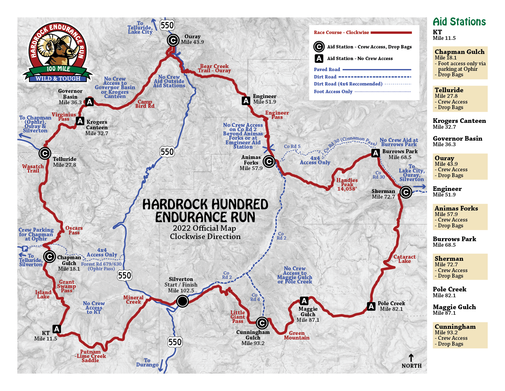
Four legs, linking the Lake City, Ouray, Telluride, and Silverton areas. The finish is in Silverton, the same location as the start. The course is approximately 102.5 miles long, has a cumulative vertical gain of roughly 33,197 feet of climb and 33,197 feet of descent for a total elevation change of 66,394 feet, and takes place at an average elevation of about 11,000 feet. The high point is 14,048 feet.
This is a test of runners against the mountains. The course is on trails as much as possible. There are 14 aid stations; major aid stations will be located in the towns with less well-equipped aid stations in between. Runners are expected to be largely self-supporting between the towns.
The altitude range of this run (7,700 to 14,000+ feet) takes the runner through several climate zones. At the lower altitude, forests of aspen, pine, and spruce are common. Timberline is locally at about 11,800 feet, though this can vary greatly. Above timberline is alpine tundra and low vegetation interspersed with krummholz (low, stunted spruce, fir, and willow).
In the summer, animal life is abundant. You will almost certainly see elk in the high meadows, possibly with their young. Stay clear of elk: they can be ornery at times. Bears (black, not grizzlies) are present, though seldom seen. Mountain lions may also be encountered.
The run is a salute to the toughness and perseverance of the hardrock miners who lived and worked in the area.
Download Clockwise Written Course Description.